


Contact Info
2105 N. Pawnee Road
Burlington, KS 66839-8911
Burlington, KS 66839-8911
- Phone 1:
- 620-364-8613
Basics
- Number of Sites:
- 4
Amenities
Basic Amenities
- Drinking Water
- Flush Toilets
Special Features
- Playground
- Fishing
Additional Conveniences
- Boat Ramp
Details
Season
Closed through Fri Aug 16 2013Location
Getting There:GPS Info. (Latitude, Longitude):
38.25, -95.75
38°15'0"N, 95°45'0"W
From Burlington, Kansas, take US 75 north for about 3.5 miles, then turn west onto Embankment Road and continue for.3 miles and follow signs to park entrance.
Basic Info
- Total Sites:
- 4
Several trails wind through the hills and along the shore. The Otter Creek ATV area is located at the west end of the dam and provides 140 acres of trails for dirt bikes and ATVs. The area is open from sunrise to sunset.
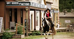
The Hickory Creek Trail is a multi-use trail for the hiker, horseback rider and mountain biker, providing 11 miles of scenic trail, forging through the creek at several crossing locations.

