Kansas Map

Facebook Twitter Google+
Follow The Go Travel Sites on Facebook

  • Places To Go

    A summary of what Topeka has to offer.

    Summary list of destinations near Topeka.

    Explore travel information for Kansas cities, towns, parks, regions and more.

    Coverage for every state in the United States.

    Explore neighboring countries (and soon countries throughout the world).

    Topeka

    State capital Topeka has the expected selection of governmental sites but also find in this pleasant town a number of historic attractions, a museum or two and easily accessible lakeside activity.

  • Things To Do

    Searchable list of Topeka tour companies, guides and outfitters, rental companies and more.

    Full information on Topeka Tourist Attractions, Scenic Drives and other easy vacation activities…

    Detailed information on active pursuits in Topeka such as biking, hiking, golfing and much more.

    Searchable lists of Topeka museums, parks, galleries, and more.

    Introduction to all the things to do in Kansas.

    Searchable list of tour companies, guides and outfitters, rental companies and more.

    Full information on Tourist Attractions, Scenic Drives, Sightseeing Tours and easy vacation activities..

    Detailed information on active pursuits such as biking, hiking, golfing and much more.

    Museums, parks, galleries, zoos, and everything else you could want to do in Kansas.

    Things To Do

    Set off in search of the Wild West in Dodge City, track down historic sites in Topeka and catch cultural riverside activity in Witchita

    Learn More
  • Sleep + Eat

    Searchable listings of Topeka hotels, motels, resorts, bed & breakfast, and more.

    Searchable listings of Topeka RV parks and campgrounds.

    Searchable listings of Kansas hotels, motels, resorts, bed & breakfast, and more.

    Searchable listings of Kansas RV parks and campgrounds.

    Lodging and Hotels

    Use our easy Lodging Search to find exactly the type of accommodation you are looking for at the right price.

    Search Now
  • Travel Planning

    Request Free Travel brochures for Topeka.

    Transportation companies, driving directions and more for Topeka.

    Topeka weather report, historic temperatures and climate info,…

    Searchable lists of Topeka tourism offices and other helpful government agencies.

    Explore destinations near Topeka.

    Request Free Travel brochures from destinations throughout Kansas.

    Transportation companies, airports and interactive maps for Kansas.

    Travel and tourism books and maps for Kansas.

    Basic facts about Kansas, including a guide to every city and town in Kansas.

    Searchable lists of Kansas tourism offices and other helpful government agencies.

  • Photo Gallery

    Searchable slide shows of Kansas photos.

    Searchable slide shows of Kansas videos.

    Searchable slide shows of Topeka photos.

    Photo and Video Gallery

    Browse photos and videos from across the state, take a virtual tour, search for the imagery you want to see.

    View Now
  • Map It!

Frontier Military Scenic Byway

No Media or Maps Available
If you are the owner/manager of this business and would like to improve your listing, please submit a request.
Basics
Length:
167 miles (268 km)
Time:
3 hours
Fees:
There are no fees along the byway proper.

Description

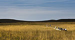
The Frontier Military Scenic Byway was designated a state bywayby the Kansas Legislature on June 15, 1990. The byway extendsroughly 167 miles tying Fort Leavenworth to the north with FortScott at the south and then onward to the Oklahoma border. Itfollows K-5 out of Leavenworth to I-435, then follows U.S. 69 andAlternate U.S.69 to the state line. The route approximates the oldmilitary trail used by the Army to transport troops and suppliesbetween the frontier forts.

The Frontier Military Scenic Byway contains unique historic,natural and recreational attractions and sites. In addition, ajoint project by the Fort Scott Chamber of Commerce, KansasDepartment of Wildlife and Parks and Quail Unlimited, is plantingnative wildflowers along the byway. The route is primarily atwo-lane, paved roadway with one interstate segment. It offers manyamenities along the way. The local committee is in the process ofdeveloping additional amenities for the future including an outdoor reenactment site at Mine Creek.

Points of Interest Along The Way

Fort Scott, Kansas (KS)

Directions

The fort's primary purpose was to keep peace between therelocated Indians from the east, nomadic tribes and white settlers.As it turned out the Indians were quiet and the main duties were toguard caravans on the Sante Fe Trail and patrol the far IndianCountry. The area where the fort was built had been the ancestralland of the Osage. The fort was in use from 1842 to 1853. In the1870s, the U.S. Army returned to the town of Fort Scott, this timeto protect workers building a railroad across disputed land.

Length:
167 miles (268 km)
Time:
3 hours
Main Roads:
US-69 S
Fees:
There are no fees along the byway proper.
Customizable Directions

Formatted DirectionsMap

Email Page Link

Complete the form below to email this page to a friend or family member's email. You can send yourself an email as well. Your email and your recipient's email will NOT be shared with anyone. See our full Privacy Policy for details.
:
:
:


:
Copy Yourself on the Email Yes No
:
: